|
| at: |
Bienville National Forest |
Data from USFS GIS
 show on map
 animate
Trail users:


Elevation Profile
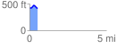
 0.512551 mi
 54.88 ft
 61.04 ft
 -6.17 ft
 2.26 %
GPX Downloads: Track Route
![]()
|
| at: |
Bienville National Forest |
show on map
animate
0.512551 mi
54.88 ft
61.04 ft
-6.17 ft
2.26 %