|
| at: |
Bienville National Forest |
Data from USFS GIS
 show on map
 animate
Trail users:


Elevation Profile
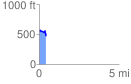
 0.427951 mi
 44.88 ft
 138.13 ft
 -93.25 ft
 6.11 %
GPX Downloads: Track Route
![]()
|
| at: |
Bienville National Forest |
show on map
animate
0.427951 mi
44.88 ft
138.13 ft
-93.25 ft
6.11 %