|
| at: |
Bienville National Forest |
Data from USFS GIS
 show on map
 animate
Trail users:


Elevation Profile
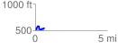
 0.636462 mi
 125.38 ft
 76.69 ft
 48.69 ft
 3.73 %
GPX Downloads: Track Route
![]()
|
| at: |
Bienville National Forest |
show on map
animate
0.636462 mi
125.38 ft
76.69 ft
48.69 ft
3.73 %