| at: |
DeSoto National Forest - Chickasawhay District |
Data from USFS GIS
 show on map
 animate
Trail users:


Elevation Profile
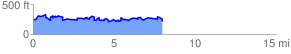
 10.536930 mi
 2205.84 ft
 2195.13 ft
 10.71 ft
 3.96 %
GPX Downloads: Track Route
![]()
| at: |
DeSoto National Forest - Chickasawhay District |
show on map
animate
10.536930 mi
2205.84 ft
2195.13 ft
10.71 ft
3.96 %