| at: |
DeSoto National Forest - South |
Data from USFS GIS
 show on map
 animate
Trail users:


Elevation Profile
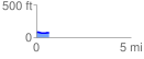
 0.671859 mi
 17.77 ft
 25.23 ft
 -7.47 ft
 0.71 %
GPX Downloads: Track Route
![]()
| at: |
DeSoto National Forest - South |
show on map
animate
0.671859 mi
17.77 ft
25.23 ft
-7.47 ft
0.71 %