| at: |
DeSoto National Forest - South |
Data from USFS GIS
 show on map
 animate
Trail users:


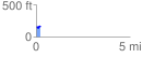
Elevation Profile
 0.219945 mi
 32.94 ft
 11.66 ft
 21.28 ft
 2.84 %
GPX Downloads: Track Route
![]()
| at: |
DeSoto National Forest - South |
show on map
animate
0.219945 mi
32.94 ft
11.66 ft
21.28 ft
2.84 %