| at: |
Homochitto National Forest |
Data from USFS GIS
 show on map
 animate
Trail users:


Elevation Profile
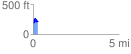
 0.281429 mi
 98.23 ft
 62.44 ft
 35.79 ft
 6.61 %
GPX Downloads: Track Route
![]()
| at: |
Homochitto National Forest |
show on map
animate
0.281429 mi
98.23 ft
62.44 ft
35.79 ft
6.61 %