| at: |
Amicalola/Nimblewill/Tickanetley |
Data from David Muse
 show on map
 animate
Trail users:


Elevation Profile
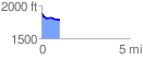
 1.026665 mi
 13.22 ft
 125.30 ft
 -112.08 ft
 2.31 %
GPX Downloads: Track Route
![]()
| at: |
Amicalola/Nimblewill/Tickanetley |
show on map
animate
1.026665 mi
13.22 ft
125.30 ft
-112.08 ft
2.31 %