| at: |
Homochitto National Forest |
Data from USFS GIS
 show on map
 animate
Trail users:


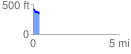
Elevation Profile
 0.364834 mi
 27.07 ft
 96.87 ft
 -69.80 ft
 5.03 %
GPX Downloads: Track Route
![]()
| at: |
Homochitto National Forest |
show on map
animate
0.364834 mi
27.07 ft
96.87 ft
-69.80 ft
5.03 %