| at: |
Homochitto National Forest |
Data from USFS GIS
 show on map
 animate
Trail users:


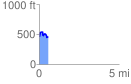
Elevation Profile
 0.555031 mi
 143.18 ft
 155.80 ft
 -12.62 ft
 5.32 %
GPX Downloads: Track Route
![]()
| at: |
Homochitto National Forest |
show on map
animate
0.555031 mi
143.18 ft
155.80 ft
-12.62 ft
5.32 %