| at: |
Rich Mountain Blue Ridge WMA Rich Mountain WMA - Cartecay Tract Amicalola/Nimblewill/Tickanetley |
Data from David Muse
 show on map
 animate
Trail users:


Elevation Profile
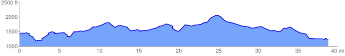
 39.477740 mi
 3513.37 ft
 3628.72 ft
 -115.35 ft
 1.74 %
GPX Downloads: Track Route