| at: |
Homochitto National Forest |
Data from USFS GIS
 show on map
 animate
Trail users:


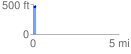
Elevation Profile
 0.150327 mi
 31.55 ft
 17.01 ft
 14.54 ft
 3.97 %
GPX Downloads: Track Route
![]()
| at: |
Homochitto National Forest |
show on map
animate
0.150327 mi
31.55 ft
17.01 ft
14.54 ft
3.97 %