| at: |
Homochitto National Forest |
Data from USFS GIS
 show on map
 animate
Trail users:


Elevation Profile
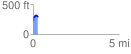
 0.289749 mi
 90.48 ft
 77.83 ft
 12.65 ft
 5.91 %
GPX Downloads: Track Route
![]()
| at: |
Homochitto National Forest |
show on map
animate
0.289749 mi
90.48 ft
77.83 ft
12.65 ft
5.91 %