| at: |
Homochitto National Forest |
Data from USFS GIS
 show on map
 animate
Trail users:


Elevation Profile
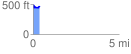
 0.379040 mi
 125.38 ft
 85.79 ft
 39.59 ft
 6.26 %
GPX Downloads: Track Route
![]()
| at: |
Homochitto National Forest |
show on map
animate
0.379040 mi
125.38 ft
85.79 ft
39.59 ft
6.26 %