| at: |
Homochitto National Forest |
Data from USFS GIS
 show on map
 animate
Trail users:


Elevation Profile
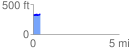
 0.440783 mi
 40.47 ft
 35.96 ft
 4.51 ft
 1.74 %
GPX Downloads: Track Route
![]()
| at: |
Homochitto National Forest |
show on map
animate
0.440783 mi
40.47 ft
35.96 ft
4.51 ft
1.74 %