| at: |
Homochitto National Forest |
Data from USFS GIS
 show on map
 animate
Trail users:


Elevation Profile
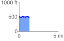
 1.303804 mi
 180.29 ft
 210.69 ft
 -30.41 ft
 3.06 %
GPX Downloads: Track Route
![]()
| at: |
Homochitto National Forest |
show on map
animate
1.303804 mi
180.29 ft
210.69 ft
-30.41 ft
3.06 %