| at: |
Homochitto National Forest |
Data from USFS GIS
 show on map
 animate
Trail users:


Elevation Profile
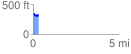
 0.302083 mi
 40.57 ft
 61.51 ft
 -20.95 ft
 3.86 %
GPX Downloads: Track Route
![]()
| at: |
Homochitto National Forest |
show on map
animate
0.302083 mi
40.57 ft
61.51 ft
-20.95 ft
3.86 %