| at: |
Homochitto National Forest |
Data from USFS GIS
 show on map
 animate
Trail users:


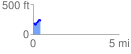
Elevation Profile
 0.437073 mi
 104.19 ft
 41.54 ft
 62.65 ft
 4.51 %
GPX Downloads: Track Route
![]()
| at: |
Homochitto National Forest |
show on map
animate
0.437073 mi
104.19 ft
41.54 ft
62.65 ft
4.51 %