| at: |
Homochitto National Forest |
Data from USFS GIS
 show on map
 animate
Trail users:


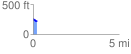
Elevation Profile
 0.226537 mi
 39.17 ft
 45.88 ft
 -6.71 ft
 3.84 %
GPX Downloads: Track Route
![]()
| at: |
Homochitto National Forest |
show on map
animate
0.226537 mi
39.17 ft
45.88 ft
-6.71 ft
3.84 %