| at: |
Homochitto National Forest |
Data from USFS GIS
 show on map
 animate
Trail users:


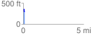
Elevation Profile
 0.116531 mi
 3.70 ft
 69.69 ft
 -65.99 ft
 11.33 %
GPX Downloads: Track Route
![]()
| at: |
Homochitto National Forest |
show on map
animate
0.116531 mi
3.70 ft
69.69 ft
-65.99 ft
11.33 %