| at: |
Homochitto National Forest |
Data from USFS GIS
 show on map
 animate
Trail users:


Elevation Profile
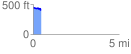
 0.461910 mi
 21.98 ft
 60.16 ft
 -38.18 ft
 2.47 %
GPX Downloads: Track Route
![]()
| at: |
Homochitto National Forest |
show on map
animate
0.461910 mi
21.98 ft
60.16 ft
-38.18 ft
2.47 %