| at: |
Kisatchie National Forest - Caney District |
Data from USFS GIS
 show on map
 animate
Trail users:


Elevation Profile
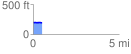
 0.515662 mi
 8.78 ft
 16.58 ft
 -7.80 ft
 0.61 %
GPX Downloads: Track Route
![]()
| at: |
Kisatchie National Forest - Caney District |
show on map
animate
0.515662 mi
8.78 ft
16.58 ft
-7.80 ft
0.61 %