| at: |
Kisatchie National Forest - Caney District |
Data from USFS GIS
 show on map
 animate
Trail users:


Elevation Profile
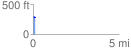
 0.126003 mi
 5.06 ft
 4.58 ft
 0.48 ft
 0.76 %
GPX Downloads: Track Route
![]()
| at: |
Kisatchie National Forest - Caney District |
show on map
animate
0.126003 mi
5.06 ft
4.58 ft
0.48 ft
0.76 %