| at: |
Blue Ridge WMA |
Data from David Muse
 show on map
 animate
Trail users:


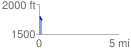
Elevation Profile
 0.191692 mi
 0.00 ft
 64.47 ft
 -64.47 ft
 6.37 %
GPX Downloads: Track Route
![]()
| at: |
Blue Ridge WMA |
show on map
animate
0.191692 mi
0.00 ft
64.47 ft
-64.47 ft
6.37 %