| at: |
Fort Mountain State Park Area |
Data from David Muse
 show on map
 animate
Trail users:


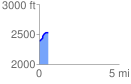
Elevation Profile
 0.594802 mi
 143.29 ft
 1.14 ft
 142.15 ft
 4.56 %
GPX Downloads: Track Route
![]()
| at: |
Fort Mountain State Park Area |
show on map
animate
0.594802 mi
143.29 ft
1.14 ft
142.15 ft
4.56 %