| at: |
Sumter National Forest - Enoree District |
Data from USFS GIS
 show on map
 animate
Trail users:


Elevation Profile
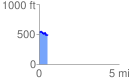
 0.529882 mi
 47.94 ft
 86.42 ft
 -38.48 ft
 3.09 %
GPX Downloads: Track Route
![]()
| at: |
Sumter National Forest - Enoree District |
show on map
animate
0.529882 mi
47.94 ft
86.42 ft
-38.48 ft
3.09 %