| at: |
Bonnet Carre Spillway |
Data from David Muse
 show on map
 animate
Trail users:

Elevation Profile
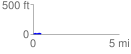
 0.451133 mi
 21.33 ft
 18.37 ft
 2.95 ft
 0.90 %
GPX Downloads: Track Route
![]()
| at: |
Bonnet Carre Spillway |
show on map
animate
0.451133 mi
21.33 ft
18.37 ft
2.95 ft
0.90 %