| at: |
Levee Bike Path (Baton Rouge Area) |
Data from David Muse
 show on map
 animate
Trail users:


Elevation Profile
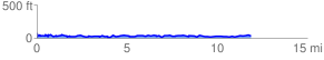
 12.015495 mi
 848.08 ft
 850.71 ft
 -2.62 ft
 1.34 %
GPX Downloads: Track Route
![]()
| at: |
Levee Bike Path (Baton Rouge Area) |
show on map
animate
12.015495 mi
848.08 ft
850.71 ft
-2.62 ft
1.34 %