| at: |
Mockingbird Trail |
Data from David Muse
 show on map
 animate
Presumedly hike-only. Not marked though.
Trail users:
Elevation Profile
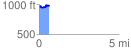
 0.631740 mi
 92.52 ft
 86.29 ft
 6.23 ft
 2.77 %
GPX Downloads: Track Route
Trailheads:
 Barnes Mill Clubhouse Lot