| at: |
Burnt Mountain |
Data from David Muse
 show on map
 animate
Trail users:


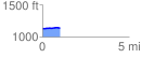
Elevation Profile
 1.019435 mi
 24.25 ft
 16.24 ft
 8.01 ft
 0.45 %
GPX Downloads: Track Route
![]()
| at: |
Burnt Mountain |
show on map
animate
1.019435 mi
24.25 ft
16.24 ft
8.01 ft
0.45 %