| at: |
Burnt Mountain |
Data from David Muse
 show on map
 animate
Trail users:


Elevation Profile
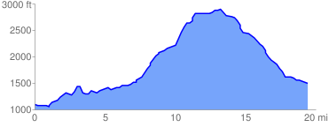
 19.710140 mi
 2624.11 ft
 2192.98 ft
 431.14 ft
 2.52 %
GPX Downloads: Track Route
![]()
| at: |
Burnt Mountain |
show on map
animate
19.710140 mi
2624.11 ft
2192.98 ft
431.14 ft
2.52 %