| at: |
Talty/Crandall Area Roads |
Data from David Muse
 show on map
 animate
Trail users:


Elevation Profile
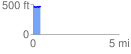
 0.420704 mi
 20.60 ft
 19.19 ft
 1.41 ft
 0.93 %
GPX Downloads: Track Route
![]()
| at: |
Talty/Crandall Area Roads |
show on map
animate
0.420704 mi
20.60 ft
19.19 ft
1.41 ft
0.93 %