| at: |
Southside Park |
Data from David Muse
 show on map
 animate
Trail users:


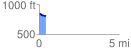
Elevation Profile
 0.404417 mi
 32.12 ft
 59.19 ft
 -27.07 ft
 2.77 %
GPX Downloads: Track Route
![]()
| at: |
Southside Park |
show on map
animate
0.404417 mi
32.12 ft
59.19 ft
-27.07 ft
2.77 %