| at: |
Southside Park |
Data from David Muse
 show on map
 animate
Trail users:


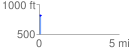
Elevation Profile
 0.126798 mi
 5.97 ft
 16.83 ft
 -10.86 ft
 2.51 %
GPX Downloads: Track Route
![]()
| at: |
Southside Park |
show on map
animate
0.126798 mi
5.97 ft
16.83 ft
-10.86 ft
2.51 %