| at: |
Serenbe |
Data from David Muse
 show on map
 animate
Trail users:


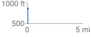
Elevation Profile
 0.144395 mi
 31.79 ft
 1.15 ft
 30.64 ft
 4.17 %
GPX Downloads: Track Route
![]()
| at: |
Serenbe |
show on map
animate
0.144395 mi
31.79 ft
1.15 ft
30.64 ft
4.17 %