| at: |
Serenbe |
Data from David Muse
 show on map
 animate
Trail users:


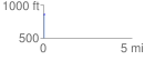
Elevation Profile
 0.056870 mi
 0.36 ft
 15.88 ft
 -15.52 ft
 5.29 %
GPX Downloads: Track Route
![]()
| at: |
Serenbe |
show on map
animate
0.056870 mi
0.36 ft
15.88 ft
-15.52 ft
5.29 %