| at: |
Serenbe |
Data from David Muse
 show on map
 animate
Trail users:


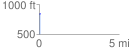
Elevation Profile
 0.057365 mi
 0.00 ft
 18.70 ft
 -18.70 ft
 6.17 %
GPX Downloads: Track Route
![]()
| at: |
Serenbe |
show on map
animate
0.057365 mi
0.00 ft
18.70 ft
-18.70 ft
6.17 %