| at: |
Serenbe |
Data from David Muse
 show on map
 animate
Trail users:


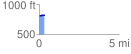
Elevation Profile
 0.337480 mi
 33.86 ft
 14.17 ft
 19.69 ft
 1.90 %
GPX Downloads: Track Route
![]()
| at: |
Serenbe |
show on map
animate
0.337480 mi
33.86 ft
14.17 ft
19.69 ft
1.90 %