| at: |
Dunnellon Trail |
Data from Karlos Bernart
 show on map
 animate
Trail users:


Elevation Profile
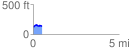
 0.523503 mi
 45.67 ft
 29.36 ft
 16.31 ft
 1.65 %
GPX Downloads: Track Route
![]()
| at: |
Dunnellon Trail |
show on map
animate
0.523503 mi
45.67 ft
29.36 ft
16.31 ft
1.65 %