| at: |
Dunnellon Trail |
Data from Karlos Bernart
 show on map
 animate
Trail users:


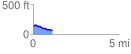
Elevation Profile
 1.147397 mi
 24.15 ft
 91.93 ft
 -67.78 ft
 1.52 %
GPX Downloads: Track Route
![]()
| at: |
Dunnellon Trail |
show on map
animate
1.147397 mi
24.15 ft
91.93 ft
-67.78 ft
1.52 %