| at: |
Horseshoe |
Data from David Muse
 show on map
 animate
Trail users:

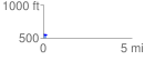
Elevation Profile
 0.180828 mi
 2.43 ft
 33.37 ft
 -30.94 ft
 3.49 %
GPX Downloads: Track Route
![]()
| at: |
Horseshoe |
show on map
animate
0.180828 mi
2.43 ft
33.37 ft
-30.94 ft
3.49 %