| at: |
Thomson Trails |
Data from David Muse
 show on map
 animate
Trail users:


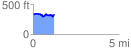
Elevation Profile
 1.248473 mi
 189.63 ft
 192.88 ft
 -3.25 ft
 2.93 %
GPX Downloads: Track Route
![]()
| at: |
Thomson Trails |
show on map
animate
1.248473 mi
189.63 ft
192.88 ft
-3.25 ft
2.93 %