| at: |
Thomson Trails |
Data from David Muse
 show on map
 animate
Trail users:


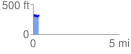
Elevation Profile
 0.340000 mi
 59.78 ft
 66.70 ft
 -6.92 ft
 3.72 %
GPX Downloads: Track Route
![]()
| at: |
Thomson Trails |
show on map
animate
0.340000 mi
59.78 ft
66.70 ft
-6.92 ft
3.72 %