|
| at: |
Iron Mountain/Sumac Creek |
Data from David Muse
 show on map
 animate
Trail users:


Elevation Profile
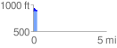
 0.291379 mi
 68.39 ft
 39.87 ft
 28.52 ft
 4.45 %
GPX Downloads: Track Route
![]()
|
| at: |
Iron Mountain/Sumac Creek |
show on map
animate
0.291379 mi
68.39 ft
39.87 ft
28.52 ft
4.45 %