|
| at: |
Johns Mountain WMA |
Data from David Muse
 show on map
 animate
Trail users:


Elevation Profile
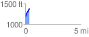
 0.386676 mi
 199.71 ft
 0.00 ft
 199.71 ft
 9.78 %
GPX Downloads: Track Route
![]()
|
| at: |
Johns Mountain WMA |
show on map
animate
0.386676 mi
199.71 ft
0.00 ft
199.71 ft
9.78 %