|
| at: |
South Oconee National Forest |
Data from David Muse
 show on map
 animate
Trail users:


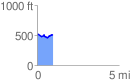
Elevation Profile
 0.953989 mi
 76.05 ft
 89.35 ft
 -13.30 ft
 1.77 %
GPX Downloads: Track Route
![]()
|
| at: |
South Oconee National Forest |
show on map
animate
0.953989 mi
76.05 ft
89.35 ft
-13.30 ft
1.77 %