| at: |
Amicalola/Nimblewill/Tickanetley |
Data from USFS GIS
 show on map
 animate
Trail users:


Elevation Profile
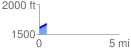
 0.469458 mi
 73.78 ft
 31.79 ft
 41.99 ft
 2.98 %
GPX Downloads: Track Route
![]()
| at: |
Amicalola/Nimblewill/Tickanetley |
show on map
animate
0.469458 mi
73.78 ft
31.79 ft
41.99 ft
2.98 %