|
| at: |
South Oconee National Forest |
Data from David Muse
 show on map
 animate
Trail users:


Elevation Profile
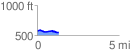
 1.315766 mi
 59.83 ft
 76.15 ft
 -16.32 ft
 1.10 %
GPX Downloads: Track Route
![]()
|
| at: |
South Oconee National Forest |
show on map
animate
1.315766 mi
59.83 ft
76.15 ft
-16.32 ft
1.10 %