|
| at: |
Johns Mountain WMA |
Data from David Muse
 show on map
 animate
Trail users:


Elevation Profile
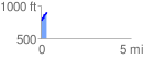
 0.340085 mi
 117.57 ft
 6.22 ft
 111.35 ft
 6.55 %
GPX Downloads: Track Route
![]()
|
| at: |
Johns Mountain WMA |
show on map
animate
0.340085 mi
117.57 ft
6.22 ft
111.35 ft
6.55 %