|
| at: |
Beasley Knob |
Data from David Muse
 show on map
 animate
USFS GIS data shows part of this road as both FS117 and Bridge Gap Trail.
Trail users:


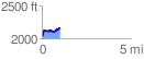
Elevation Profile
 1.019239 mi
 221.11 ft
 96.97 ft
 124.15 ft
 4.11 %
GPX Downloads: Track Route